Sunday 29 June 2014

Days 55 - 57: La Paz: The City In A Ravine

La Paz and the 6000er Illimani in the background
When we arrived in La Paz we went to a Dutch cafe for breakfast.  Why Dutch?  No idea.  Why are there so many Dutch bars and cafes in Bolivia?  Why do all the backpackers hang out in them?  Are we looking for Europe in South America?  Or we just hoping that we've finally found a cafe where food poisoning isn't included as a free side-dish?  Pass.  But in general we didn't go for many 'Bolivian' dishes in La Paz.  Instead, we ate vegetarian burritos in a Mexican restaurant, saag paneer in an English-Indian curry house, more vegetarian burritos, and finally vegetarian take-away pizza.  Someone else was free to hog the Bolivian vegetarian delicacy of fried, grilled or boiled chicken.

But the rest of La Paz looks nothing like England, Italy, Mexico or India.  There are a few tourist streets where every shop sells Pachamama (earth mother) jewellery or woolly jumpers, hats, socks, gloves, even full-face masks.  I used the loss of my fleece as an excuse to invest in an alpaca jumper and some cosy gloves (although an end to whinging about having cold fingers remains a distant prospect).  In the process, I lost my sunglasses and had to nip down to a sunglass stall to see if I could buy them back again.  My replacement pair cost £3.50 and were in four different pieces only three days later.  Not the best buy of the trip.

Tiwanaku monolith
Outside the tourist area, La Paz represents a chaotic world.  It's a city built on forty-five degrees, clinging to the sides of a steep river valley with its suburbs topping-out triumphantly on the crest.  A substantial proportion of its population are four-wheeled beings - high-emission, clapped-out cars, fuming helplessly in inert lines.  We discovered the intensity of the traffic problem on our second morning when we took a bus trip out to the ruins of Tiwanaku.  Clearing La Paz took over an hour and involved driving along unpaved side streets and alongside a stream to clear a road block (which makes you wonder how effective the industrial action is?).  Alas, the preservation of the Tiwanaku archeological site is little better than the state of the roads.  It looks very much like a textbook case of how not to treat a site.  Over the years, the original features have been decimated by pillaging.  A few structures have been rebuilt; others began to collapse in the process of rebuilding so work stopped; yet others have seen no reconstruction at all.  Not a word of signage explains which artefact falls into which category.  Interpreting the ruins with no information and inadequate knowledge is certainly a challenge.

Yet we were glad we visited.  The Tiwanaku civilisation lasted for almost two thousand years (compared to a few hundred of Inka-dom, so how come they get all the fame?) before collapsing for reasons that remain unclear.  Dropping water levels in Lake Titicaca are sometimes held responsible.  The Tiwanaku used irrigation intensively to support a high population comparative to the available agricultural land - something that wasn't possible in times of drought.  But the artefacts at the site were mostly temples, statues of deities (some defaced with crosses), and the gates of the city's temple complex.  Some of the statues at least were well-preserved.

Tiwanaku masonry
The Sun Gate at Tiwanaku
After a cultured day musing over pre-Incan civilisations, our next day in La Paz could not have been more different.  We went biking down 'the most dangerous road in the world' - a dirt track with a precipitous drop on one side, diving into the jungle below.  It was once the main road from Coroico to the Altiplano, at which point it may well have deserved its name, but fortunately a new road has replaced it, complete with the extravagances of a metalled surface and safety barriers.  The old road has been left to backpackers with mountain bikes and a shortage of braincells - sounds like us?
Setting off on the death road

We were driven to a point well above La Paz, just below the snow-line, where we donned as much safety gear as an ice hockey player.  We then whizzed down a tarmac-ed road for about an hour.  It is possible that I turned the pedals in this time but if you blinked then you missed it.  As for gears, what are they for?  Mr Gravity was the only person who put any effort into this part of the ride.

At the end of this stretch, our van picked us up and drove us along the next section of road because it climbs for a whole eight kilometres and a backpacker cannot possibly be expected to cycle against a gradient.  We both complied but grunted that anyone who cannot cycle the uphill bits should not be allowed on the downhill bits either.  No pain no gain, and all that.

Once we were let loose on our bikes again, it was time to hit the 'death road' itself, ready to descend for several thousand metres to Coroico.  As it turned out, death didn't feel that close!  Yes, the track was rough and the drop precipitous, but the road was wide enough for a motor vehicle (just) so bikers with shaky nerves can easily hug the landward side of the road (as opposed to the BASE jump side).  I suspect that whoever named the road hasn't commuted on a bike through central London twice a day for seven years.  Bolivia, I see your 'most dangerous road' and I raise you 'Kensington High Street' at 8:15 on Monday mornings.  After all, a road cannot be truly dangerous without a fleet of murderous London cabbies playing ten-pin bowling with cyclists' bodies, can it?  Having said that, we watched a guy in a group behind us crash.  His bike flew off the cliff; his body was half way over before he managed to claw himself back.  We so nearly saw someone die.  And having saved himself from the precipice, the cyclist's girlfriend nearly killed him instead - his second near-death experience in one day.

Susan holds bike aloft in a gender-defying move!
Back to our own experience; we were cycling in a group of four of which I was the only female.  This was probably representative of the gender ratio on the road as a whole.  No doubt some would make a point about the difference in male and female psychology (acceptance of risk, thrill-seeking, adventurousness, skill-level, awareness of one's own mortality, total bonkers-ness, something else?).  I've no idea what the point is, so won't make it.  After all, I cycled the death road too.  It was also noticeable that in each group the cyclists going quickly at the front were almost exclusively male while the girls were cycling more slowly at the back.  Again, conclusions on gender differences are strictly omitted!

The most enjoyable part of the ride wasn't its thrill-seeking aspect though; it was the change in ecosystems.  From the start among snow-capped peaks, we descended into lushly vegetated jungle swirling with clouds.  We rode under waterfalls, past branches and ferns, with a bird's-eye view of the tropical river valley below.  Folds of wooded hillside undulated ahead of us.  It was all very National Geographic.  And it all unfolded in front of us as we descended towards Coroico without even the need to turn the pedals.  This was a day for the muscles around our eyes not the usual biking muscles in the legs.  It was also a day for the muscles in our forearms, squeezing the brake pads for dear life, then squeezing them a little harder.  Let's not completely forget the precipice at the side of the road after all.

Riding the death road (without bikes!)
We arrived in Coroico for a shower, a late lunch, and the opportunity to cosy up with some sand-flies in a hammock.  Guy hogged the hammock, ignorant of its existing inhabitants, and got the bites to show for it.  He recovered by putting to rights the future of mankind's energy supply, along with a French bloke who worked in a nuclear power station, on the journey back to the city.  Fortunately there was plenty of time to crack even this hefty problem, owing to the unyielding La Paz traffic.  By the time we arrived it was definitely beer-o-clock.  Oh yes, so we did try some Bolivian cuisine after all; Bolivian beer.  Even I drank it.  After thirty-four years, you could fit all the beer I've drunk in my life into a single pint glass.  By the time I leave South America, you'll need a crate.  Don't get too excited by this - I maintain that all beer is disgusting stuff - but the up-side is that the brewing process makes the water safe to drink.  In some places, that's a price-less quality.  So, time for a beer.  Actually, make it two beers.  I doubt Guy will ever ask me to look after his beer while he goes to the bathroom again!


Day 49: Uyuni

Uyuni is colourful town.  The women wear bright skirts and shawls and bowler hats; I wear a black jacket and black trousers and a brown hat.  I need to start thinking about making some many-coloured purchases.

Guy spent the day in his sleeping bag drinking flat coke and clutching his stomach.  I put Wenlock the Stuffed Traveller in the post to Bournville School, then wandered around the market.  I considered buying 'El Hobbit' but wasn't sure if my Spanish was up to it, so I stuck to buying biscuits.

When I called into the museum, the receptionist looked astonished to receive a visitor.  She showed me an artistic representation of the first nomadic inhabitants of the region, around three thousand years ago, wearing nothing but grass skirts.  As I shivered in my down jacket in the middle of the day, I found it hard to believe in its accuracy.  Another exhibit showed the pre-colombian practice of skull-binding to elongate the cranium, while a set of skeletons, wrapped in sinewy spaghetti, crouched in tiny glass cases in the corner, brown and wilting.

Back at the hotel, Guy was feeling better so we went for pizza in an American pizza place.

Day 48: The Salt Flats

Abandoned steam train graveyard in Uyuni
Guy spent the day huddled in a ball in the jeep.  The rest of us visited the salt flats - miles and miles of tesselated white hexagons and heptagons and octagons stretching into a haze on the horizon.  Patches of higher land surrounding the flats levitated and blurred in a mirage.  We tried spreading out and taking whimsical photographs with a tiny distant person standing on the hand of a large close-up person to get a sense of the scale but it was hard to capture.

One of the most enjoyable parts of the day was a short hike up a cactus island.  From the top, the eye followed the trails of jeeps across the salt flats as the only relief from the whiteness - a bit like looking at the wispy signature of planes across the sky.

In the late afternoon we reached the Cemetery of the Trains, where retired steam locomotives and wagons rust in the sunshine - an incongruous site in the middle of the desert.  The huddled ball in the jeep stirred and turned into Guy and decided to go for a wander around the Cemetery.  After a few minutes, it became a ball again and we drove to the town of Uyuni where the jeep trip ended.  The world of salt had given way to buildings and roads once more.

Cactus Island in the middle of the salt flats
BOING!!!!
Dead Thomas

Days 50 - 54: Sucre, capital of Bolivia?

Do my feet look big in these?
Dinosaur footprints near Marawa.
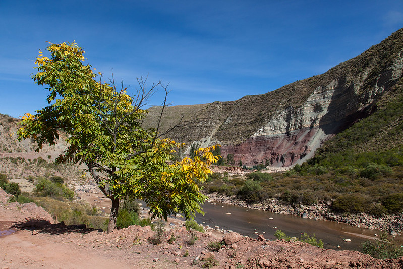
Time to leave the cold world of Uyuni and go somewhere warmer - in other words, somewhere lower.  We took the bus to Potosi: both a major mining centre in Bolivia and a beautiful town of yellow buildings and picturesque balconies.  From there, our destination of Sucre was only a few hours away.  The road took us down, down, down to a world where vegetation isn't confined to dry, golden grasses and birds other than flamingos feed.

The centre of Sucre is beautiful: every building is white with a wooden balcony and tiled roof.  Ribbons of them snake up the many hillsides on which the town is built, with cobbled streets woven into the pattern.  And when I say white houses, I mean WHITE; not the greying facades of an ageing European city.  Alas, there is a terrible reason for this.  Bolivian towns are razed to the ground by earthquakes so regularly that white buildings lack the time to fade.  Many of Sucre's colonial buildings were last destroyed in the 1940s.

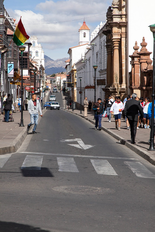
Typical Sucran street view
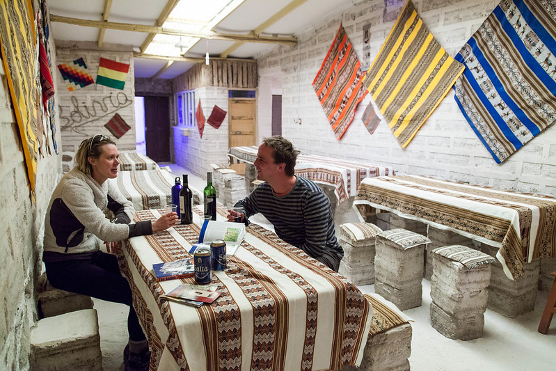
Despite the stunning surroundings, we felt trepidatious.  We were arriving in a Bolivian city without a tour guide for the first time and we had been warned about the number of kidnappings.  At the bus station, notices warned us only to take taxis from the official taxi rank, not the street.  A police officer reinforced the message and found us a cab to take us into the centre - a distance of only a couple of kilometres.  It took ages.  This couldn't be only a couple of kilometres.  As the journey dragged on, we glanced at each other.  Perhaps the police officer was a fake; we'd read about those.   Perhaps the uniform was all part of the hoax.  Perhaps we were experiencing our first Bolivian kidnapping?  Then the taxi driver pulled up outside our hostel, accepted his fare and went on his way.  Panic over.  We wandered into the centre of Sucre, which was decidedly well-to-do; we had better stow away our fears until we reached La Paz.

In the meantime, Sucre had plenty to offer.  After a day around the town, we arranged a two-day trekking trip and set out with our friendly guide, David.  The first couple of hours of walking took us down an Inca trail (I wonder how many of them there are in Bolivia?  And what is the dollar value of being able to add the word 'Inca' in front of the word 'trail'?  Substantial, surely?).  The trail led down a steep hillside into the valley, where we spent a couple of hours following the river to a church.  "The priest only comes here for one month a year," David told us, "so everyone has to get married or christened then."  In the meantime, the eucalyptus trees preside over the site, dropping their leaves so the crops cannot grow.  "It's like a plague," David told us.

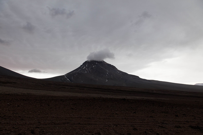
Aerial view of the Marawa crater (courtesy of Google Maps)
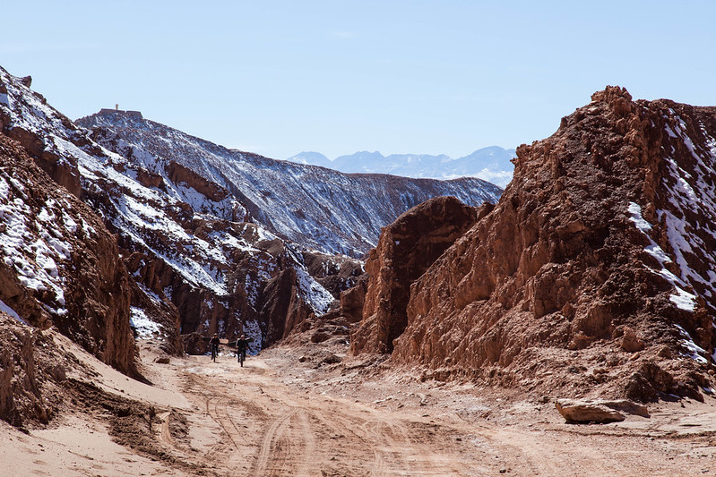
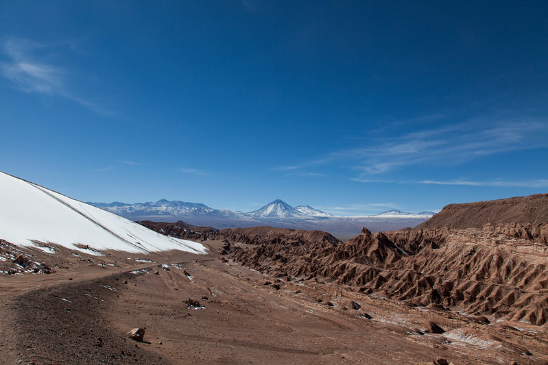
Later in the afternoon we headed up a steep path towards Marawa crater (which, for the record, is not a crater, although a more appropriate definition remains elusive).  The crumbling path, with a sheer drop to one side, looked improbable in places; thank goodness for the guide who came back and held climber-Susan's hand over the scary bits to save her from spending the afternoon gibbering over them.  Meanwhile a tiny old lady from the village below, wearing top-brand trekking gear (a cloth skirt and brightly-coloured shawl - come on North Face, get with it), skipped past us with ease and sprinted on towards the top of the path leaving us trailing in her wake.
Approaching the rim of the "crater" (probably actually an syncline)
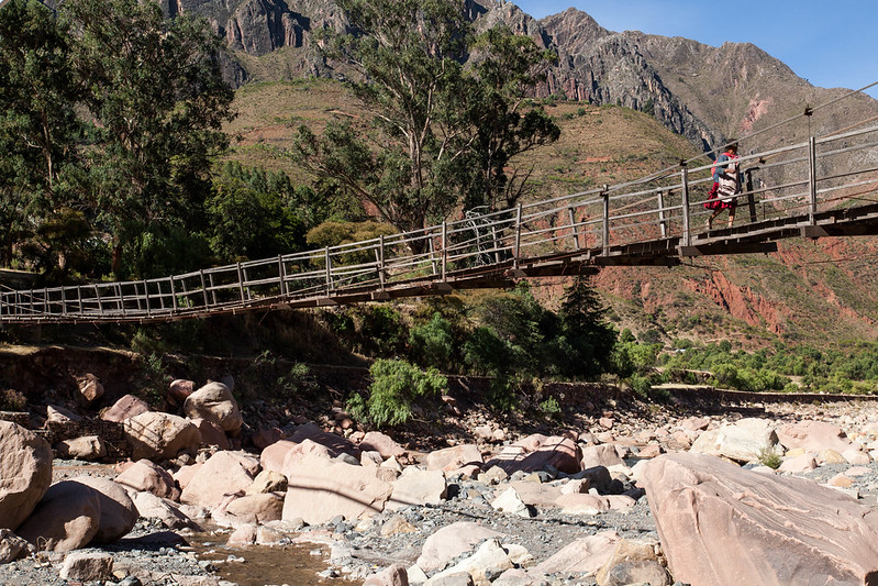
Little old lady crossing the bridge kitted in technical Bolivian mountaineering gear.
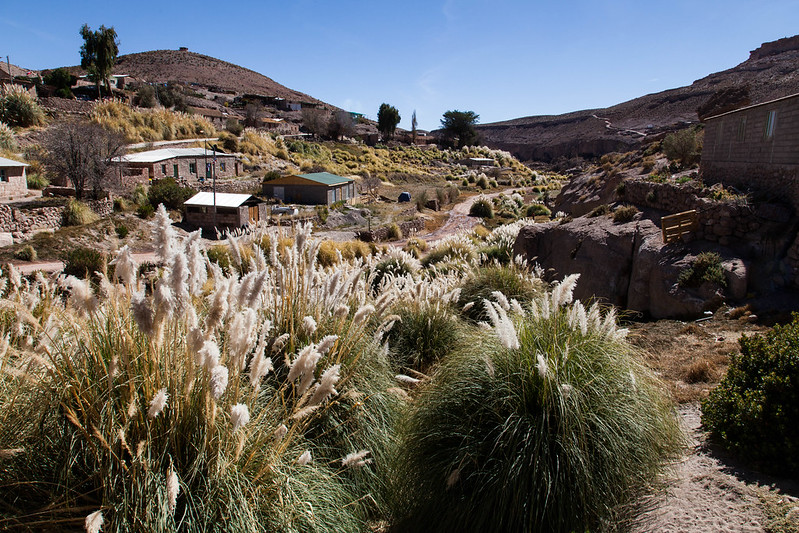
Eventually we reached the Quechua-speaking village of Marawa - a place of many colours and few teeth.  As well as the customary scattering of biscuit wrappers outside the village (nemesis of said teeth?), it is home to a large school serving the surrounding villages, a small shop (with beer in stock), and surrounding hillsides that look like a sequence of giant conch shells ranged around the rim of the crater.  We spent a pleasant evening there.

Next morning, as we climbed out of the village, we passed a number of children dashing down the hillsides to the school.  David told us that the children pretend to be frightened of tourists because their parents tell them that, if they aren't good, a foreigner will take them away in a backpack.  On hearing this, Guy pretended to lunge for a couple of kids and was greeted by shrieks of laughter.  In addition to their Spanish lessons at school, they are learning a little business early.  Almost every child had fistful of woven bracelets and fossils to try to sell to us.  But we felt the weight of our backpacks and decided against adding any rocks to them.

Leaving the Marawa crater
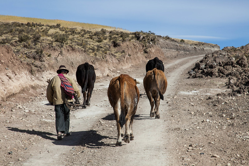
Bullocks to the trail
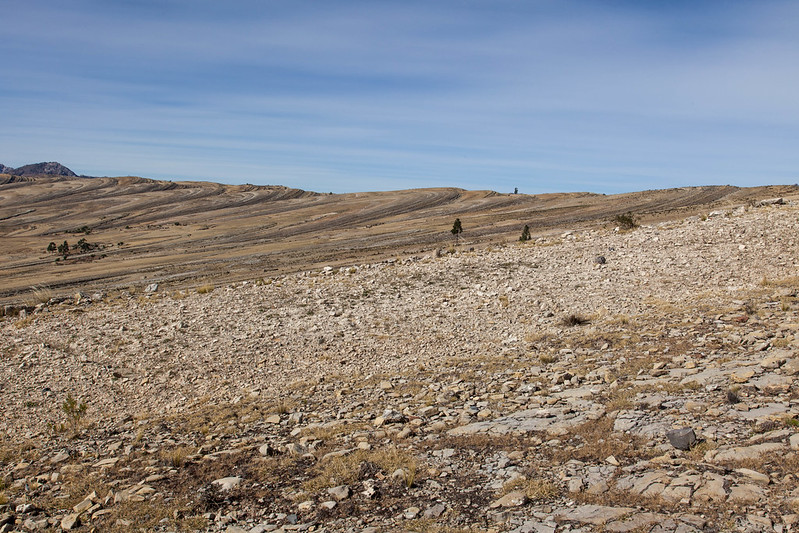
For the next couple of hours, Guy was entranced by the geology of the area.  If Marawa crater isn't a crater, what is it?  How was it formed?  He turned over various theories in his mind and tried them out on David and I.  They included words like sink-lines and concoidal fractures.  David and I perfected the art of nodding and smiling.  Professor Guy may have to fail us both in our geology lessons.

In late morning, we reached a slab of rock tilted to about thirty degrees.  A clear line of footprints from a large theropod dinosaur ran across one edge; a sauropod dinosaur had taken a slightly different route up the centre; some smaller theropods had scuttled around at random.  The theropod prints were pristine and a group of French tourists posed as dinosaurs with their faces scrunched up, their hands extended as claws, and their feet in the prints.  Guy was disgusted; these fossils may not be pristine for very much longer if many such groups come this way.  Fortunately a group of Palaeontologists have spent a year studying the traces and taking casts so the record won't be lost.

From the dinosaur rock we headed down into the valley towards our vegetarian packed lunch (chicken - what else would you feed a vegetarian?). Power lines climbed the hillsides to the villages we passed on the way and I asked if they were new.  "Yes," David told us, "they were installed a few months ago.  There is a Presidential election this autumn."  The electric lighting in Marawa was part of the same programme and equally new.  So was the President trying to woo voters in the villagers?  David thought so.  "Yet the villagers don't have to pay any taxes," he added.  We scented a slight note of being hard-done-by in the voice of this urban tax-payer.

One more question; what about health care in the villages?  "A wheelbarrow is the best ambulance," David told us, "donkeys are too slow, so you need a wheelbarrow to get to the nearest town."  Of course, of course.  A wheelbarrow!

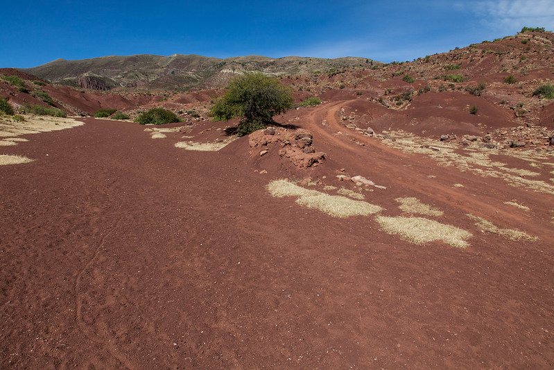
Red soil at the end of the trek
After two days of trekking amidst sunshine, intriguing rock formations and cretaceous remains, we drove back to Sucre.  I could have used a hand to hold on the return journey as our van drove much closer to a precipice than my feet had taken me the previous day.  But that's the norm here so I'd better get used to it.  At least there was a hearty dinner in a Dutch cafe to fortify us back in Sucre.  Why Dutch?  No idea.

Climbing one of the new routes
We had one more day left in Sucre so Guy went rock climbing on a nearby crag with a couple of well-reputed climbers from the area.  The low points were wading a sewage outlet to get to the crag and listening to the frustration of the climbing guides that the local tourist outfits won't give  
them any support to set new routes in the area - only to offer half-day beginners' climbing experiences to backpackers.  The high points: the second ascent of a new route on excellent rock and the ability still to on-sight F6b (albeit on a top-rope!).

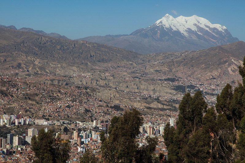
Susan, meanwhile, visited the 'Casa de la Constitucion' and other museums.  Sucre is constitutionally the capital of Bolivia as everyone who has visited the town will know.  ('Sucre, capital of Bolivia' screams from many buildings.)  "It's still the capital," we were told, "even though the government sits in La Paz".  I wonder how they feel about that in La Paz?  Well, time to find out.  We donned our down jackets and boarded the night bus, ready for a chilly ride to the city that, if the Sucrites are to be believed, isn't the capital after all.  A few days previously this wouldn't have been possible as industrial action had locked the roads into La Paz but, with the strike over, we were free to continue on our way.


Day 47: Say Cheese, Mr Flamingo

Flamingos eating brine shrimp (not cheese!)
A day of lakes.  Our Bolivian driver jolted us from one to another of them along miles of off-road tracks in a jeep which we shared with two other couples.  I will mention one of them as they crop up again later in our travels.  Tim (working in IT) and Jenny (a civil servant) were Londoners, 30-somethings, work refugees for a few months, and lovers of climbing and camping.  Sound familiar?

Together we all piled out of the jeep for half an hour beside each lake to shiver and gasp and take yet another flamingo photo.  If only these birds did not need to spend ninety percent of the time filtering the water for shrimp and would look at the camera from time to time!  Say cheese won't you, Mr Flamingo?  No?  Ah well.  The lakes were high and cold and steamed into the still air, with golden grasslands surrounding them.  Even without the birds, their photogenic properties would scarcely have been limited.

As the end of the day approached, the central theme of the landscape changed from water to salt.  We were approaching the Uyuni salt flats where we would spend the final day of the jeep tour.  Appropriately enough we stayed the night in the Salt Hotel where we crunched across a carpet of sodium chloride (salt, for the chemically-challenged).  But alas, you can't eat salt alone.  Nor can you eat the food at the Salt Hotel (a watery egg, in the absence of other vegetarian options) without danger.

We ate the food.  Guy spent the next forty-eight hours paying the price violently.

Flamingo taking off
Morning flamingos clustered around a geothermally heated part of Laguna Colorado
This rock looks like a tree apparently. I won't mention what the one behind it looks like! ;-)
Testing the ice with Jenny and Tim
Bell tower in local village
The train line from Calama to Uyuni as it enters the salt flats (just around the obvious corner!).
You've been to the Ice Hotel? Now try the Salt Hotel (just don't eat the food).

Day 46: The River Is Yellow?

Freight train heads to the Chile/Bolivia border
We were originally supposed to leave on a three-day jeep trip to Uyuni (Bolivia) two days previously but the weather had other ideas.  Even after deferring the trip, the border with Bolivia remained snowed-up and we had to get up at 4am to drive to a border crossing further north.  It took most of the day to get back on route so sightseeing was limited, although we stopped in another mini Monument Valley in mid-afternoon to ogle some rocks.

As dusk approached, the jeep driving became more hair-raising and we decided it was time to put the slings and carabiners from our climbing gear to use as seat belts (a technique we have used in India).  But just before the sun went down we realised the reason for the driver's haste; we had arrived at Laguna Colorado - a beautiful high-altitude lake, tinged with red and flecked with the pink plumage of flamingos.  We wandered along the shore and found many unhatched flamingo eggs, long after the end of the breeding season.  The driver told us that the winds are sometimes too strong up here for the eggs or young birds to survive.

We spent the night well above 4000m in accommodation known for its chill.  This may be a problem for those who stay in hotels, but for those who have been camping in the Atacama for most of the last week, the cold was never going to be a problem.  More of an issue was the lack of a bar, so Guy decided to pay a night time visit to the shop on the far side of the river.  "Hielo" ("ice") warned the cook who was preparing our dinner, warning him that the river was frozen and could only be crossed by means of a ford.  Despite feeling deeply confused by the warning that the river was "yellow", Guy wandered off and returned half an hour later looking decidedly happy with a couple of beers in his hand.  To guard against the danger of future night time drownings, the Spanish for "ice" has since become a part of his vocabulary.

Apparently this rock is shaped like a Condor. Seemingly everything is in the Andes!
Land-Cruisers mass waiting to take us on our way.
Crossing a river in Bolivia
One of two glimpses we had of a Rhea (a flightless bird related to the Ostrich)
Abandoned flamingo eggs at Laguna Colorado

Thursday 19 June 2014

Day 45: The Desert By Bike

Biking in the devil's canyon (note absence of mud)
The wind stopped, the rain stopped, the snow stopped.  The solar-heated showers in our hostel remembered how hot water is produced.  The world started looking good again.


We celebrated by deciding to take mountain bikes up to Death Valley and the Quebrada of the Devil - appropriately cheerful names, you would agree?  We wandered into a nearby bike rental shop, said we would take two bikes for the day, and got our wallets out.  But the owner had other ideas.  He simply glanced at the muddy street, which was trying and failing to swallow all of yesterday's melting snow, and shook his head.  Apparently mud is a reason not to use a mountain bike in San Pedro.  This seemed a trifle odd to me given that, in Britain, mud is exactly the reason why you would choose to ride a mountain bike rather than a slicker machine.  If this shop owner decided to set up in Scotland, he would have to change his policy on muddy rentals pronto.  But as he lives in San Pedro, home of a few muddy days a decade, I suppose he can afford to be choosy.

Feeling thwarted, we shopped around town for a bike shop sufficiently careless to let us rent bikes IN MUD and duly found one.  The next couple of hours were spent riding along the road and then up Death Valley, which threatens far lower possibilities of death to mountain bikers than its name implies (approximately none at all).  It was another beautiful desert landscape though and we had amazing views of the higher volcanos clad in snow.  I won't name a particular one of them for fear of sounding like a CD player got stuck, but rest assured that we photographed it.  The only downside of the trip was the company of a pair of friendly (nasty!) dogs.  They were pretty swift on rough ground so it was only once we got to the road we had the chance to out-sprint them.  How do you make Susan ride a bike really fast?  Put a dog on her tail and see how she goes.

After Death Valley we headed to Quebrada del Diabolo, which was about 8km up the road from San Pedro.  It was all going well until we discovered that the road was covered by a river, about 10m wide, knee-deep, very cold, and not at all rideable.  We rolled up our trousers and began wading it with bikes on our shoulders, seeing that four guys ahead of us had just crossed in the same way.  I am deeply indebted to the chivalry of Argentines after one of them waded back to take my bike from me and carry it across the river.  These days, knights wear biking helmets rather than the shiny armoured ones.  (Alas, no one offered to carry me across the river on their shoulders - just my bike.)

The ride proved well worth the river crossing.  We threaded a narrow canyon with steep walls on each side, twisting and turning upwards onto the hillside.  In a couple of places we had to dismount and lift the bikes up waist-high steps - features to watch out for on the way back down.  But the rest of the route was gentle enough to be easily rideable but challenging enough to be fun.  Let our tiny London flat be warned, we have now developed a taste for mountain biking and may need yet more gear when we return!

Back in San Pedro, it was time to fill up on pizza and dress warmly for our evening star-gazing tour run by a Canadian who has set up ten man-size telescopes in the desert to wow visitors with the clear desert skies every night.  He was knowledgeable, enthusiastic and humorous (the rough standard of humour being along the lines: 'those three stars over there are Orion's Belt and I'm afraid to say, ladies, that the stars hanging from them are just his belt'.  You get the idea.)  He started with a general talk about what we could see in the sky, including an incredibly bright Milky Way and two satellites - the Greater and Lesser Magellanic Clouds.  Then we got the chance to look through the telescopes.  One was trained on Saturn which, it turns out, looks exactly like it does in the picture books - pale-coloured and wreathed in rings.  Another showed the star Sirius, about the size of a celebrity engagement ring and shimmering with every colour of the rainbow.  Others focused on areas of the galaxy where, unbeknown to the naked eye, a mesmerising number of stars hover.

The evening ended with hot chocolate, as cold evenings should (and who better to know it than a Canadian?) before the return trip to San Pedro.  On the whole, it was an enjoyable last day in San Pedro, where we are beginning to turn into permanent pieces of the furniture!
Uh-oh, Licancabur again... oh, and Susan on a bike too.
Valle del la Muerte covered in a dusting of snow
The slope on the left is supposed to be for sand boarding. Maybe snow boarding is more appropriate?
Big skies in the Devil's Canyon. Can't remember the name of the mountain on the right though?
San Pedro's relaxing main square

Wednesday 18 June 2014

Day 43: And The Wind Still Blows

The dust storm rages.  The passes to Argentina and Bolivia are snowed up.  All of the tours are cancelled.  Most of the roads out of town are closed.  A growing number of people are stuck in San Pedro, unable to do anything except drink tea and watch the sky.

So here we are, waiting for a break in the weather and an end to the snowstorms higher up the road.  In the evening, the storm descends and it begins snowing in San Pedro.

We can't move until precipitation ceases (frozen precipitation, no less) .... in the desert.  The irony.

Perhaps Licancabur will be covered in snow tomorrow and we will have to take a few more photos of it!

Day 42: Dust Storm Central

En route to Calama in the dust storm.
Little did we know this spell of bad weather was
a once in 6 years phenomenon... just our luck!
For today, we had booked a tour of the vast Chuquicamata copper mine near Calama and for once we had company.  The  foul weather had closed the pass over to Argentina so we gave some stranded travellers a lift to Calama instead.  We drove through legions of dust, only to find the mine closed due to the storm when we arrived.  The airport, where we had to drop off the car, wasn't much better - most flights were cancelled and the car rental desk was unmanned.  Well, at least we didn't have to answer any questions about our off-road activities!  Car-less again, we all took the bus back to San Pedro.

On the way, the lurid yellow world of migrant dust created some strange effects on the surrounding mountains.  A volcano that I might have mentioned before (yes, Licancabur again) hid its head in cloud while light played on its lower slopes.  It craved to be photographed (for the last time?).

Bad weather meant abandoning our Lascar attempt. Life's too short to spend climbing volcanos in a storm!
By the time we'd driven 30 minutes the clouds had descended further... and there was still 3 more hours to drive down dirt roads to get out.
The dust storm envelops the giant wind farm near to Calama
A brief respite gives us another view of the majestic Volcan Licancabur... must go back and climb this one day!

Day 41: All The World's A Geyser

El Tatio Geysers... blimey!
Who needs an alarm clock when a fleet of backpacker buses can do the job?  Our plan for today was to camp near the El Tatio geysers, knowing that most of the tours from San Pedro visit them at dawn.  Right on cue, Guy heard the growl of buses across the desert and shook me awake (brave man).  We packed up our tent with frozen fingers (there were no balmy -5 degree temperatures to enjoy on this occasion), bundled into the truck, and followed the hordes to El Tatio.  When we got there, a square kilometre of ground was steaming like a giant pizza newly taken from the oven - with the pop of boiling cheese and all - and the sun backlighting the fumes.  Wow.

A couple of hours and a memory-card full of photos later, we headed across to the warm springs to bathe amidst the sulphur and get clean after a couple of days in the desert.  A few people were boiling eggs in the inlet of hot water feeding the pool (unfortunately we had just cooked ours the boring way, on a stove).  A few well-turned out backpackers sat in the pool in their bikinis looking fully human (unlike us): well, they would just have to cope with a couple of grizzly unshaven campers sharing their abode.  We took the plunge, only to find that Mr Mantle had not done the greatest of jobs on the heating front; the water wasn't up to the standards of a good hot bath.  But if we lounged near the egg-cooker inlet then we could have a hot back and cold front, which averages out pretty nicely.  It was actually quite pleasant, lying back in the water, watching hundreds of geysers smoking avidly, feeling the cold air on our faces.  Getting out of the pool, into said air, was less pleasant, but needs must.

In the afternoon we drove to a tiny village clinging to the sides of a river.  Its inhabitants relied for survival on the produce of some terraced fields by the water side.  The strip of green looked narrow and fragile surrounded by miles of yellow-brown.  Good luck with their apple-growing!

At this point we still had one day to spare before returning our trusty four-wheeled home to Calama.  We had already visited all the places on our wish list so what should we do with the spare day?  Well, Volcan Lascar seemed to have stopped belching and we knew guided trips had ventured there in the last few days.  It must be time to give it another shot.

We drove south to the volcano, then turned off onto a 40km four-wheel drive track.  If we broke down up here, we had a long long walk ahead of us to get help.  The wind clearly sensed that we were in need of reassurance and kindly started blowing a hoolie; we struggled to keep our tent earthbound.  It was too cold and windy to light the stove so we had to rely on avocados for dinner (did I mention that I like them?).  Then we settled down for a night in down jackets as well as sleeping bags.  It was grim.

Every other night in the desert had been cold but stunning, canopied with shooting stars.  But this campsite was cold and miserable, star-less, comfort-less, made for hatching plans of escape.  The wind blew through the mesh window in our tent all night and covered our sleeping bags in dust.  By morning, my red bag and Guy's black one had both turned brown.  At dawn we peeped out to find that the sun had done a runner in the night.  Lascar hid in clouds that (for once) were not of its own making.  So did the rest of the desert.  Snow dusted the higher slopes.  Time to get out of here.  Back to San Pedro again!